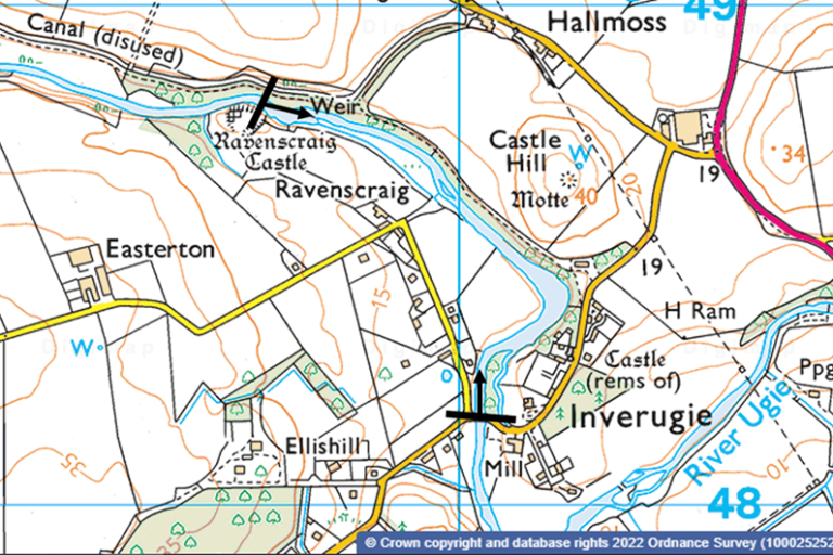
The upper limit of the site starts at Ravenscraig Castle (grid reference: NK 09604 48814) and ends at Inverugie Bridge (grid reference: NK 10047 48176) (see Map 1). Ownership is shared between several individuals including two major landowners – one of whom actively controls Himalayan balsam on their land, whilst the other gave permission for project staff and volunteers to carry out control on their land. Members of the Ugie Angling Association also assisted with control work.
Within the Scottish Invasive Species Initiative partnership, the Ugie catchment is covered by the Deveron, Bogie and Isla Rivers Charitable Trust.
2. Background
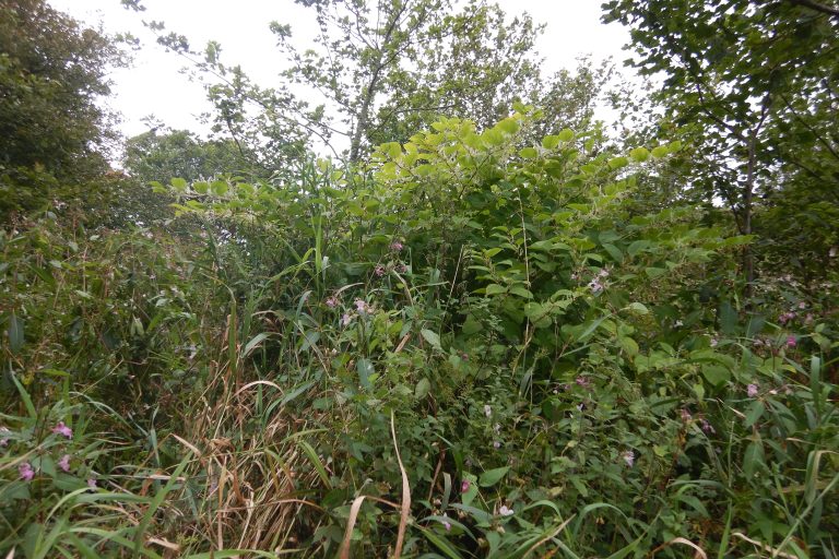
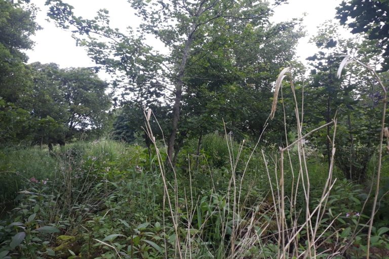
While more sporadic low-density areas of Himalayan balsam can be found higher upstream, this site is where the high abundance infestations of Himalayan balsam start on the mainstem of the River Ugie. Seed, likely to have originated from an upstream source, has found ideal growing conditions on a bend of the river on the left bank, where it has become established and is now dominant. It has also spread further downstream from there, establishing to varying densities on both banks.
This section of the River Ugie was identified for control by the Scottish Invasive Species Initiative during surveys in 2018. When first identified, Himalayan balsam was the dominant species on the left bank of the river in many areas and occurred frequently on the right bank amongst other vegetation. Due to its high abundance, Himalayan balsam – and in one area Japanese knotweed – was outcompeting native ground flora. Himalayan balsam has a shallow root system making it easy to remove by hand pulling but both species increase the risk of bank erosion and bank collapse in winter when they die back leaving the banks exposed.
Once the Scottish Invasive Species Initiative alerted the two major landowners to the Himalayan balsam and Japanese knotweed problem, both were supportive of control taking place. One helped to remove Himalayan balsam through mowing on their land whilst the other provided consent for control to take place through the project. Project officers, volunteers and members of the Ugie Angling Association carried out physical control here and elsewhere on the site.
3. Management works
Himalayan balsam was first treated in 2018 and Japanese knotweed in 2019 – this has been followed by annual control and monitoring in 2019, 2020, 2021 and 2022 for both species.
Two control methods were used for the Himalayan balsam removal – hand pulling and strimming. Strimming was used as a control method due to the presence of a Himalayan balsam monoculture with few native species present.
Stem injection and spraying were used to treat Japanese knotweed. Table 1 below shows a summary of the control treatments.
Table 1 – Summary of control treatments at Ravenscraig to Inverugie Bridge, River Ugie (2018 – 2022)
| Year |
Invasive Species |
Control work completed by |
Date and control method |
| |
|
|
|
| 2018 |
Himalayan balsam |
Landowner |
July/August – Pulling |
| 2019 |
Himalayan balsam |
Volunteers/Landowner/ Project staff |
July/August – Pulling and strimming |
| 2020 |
Himalayan balsam |
Landowner/Project Staff |
July/August – Pulling and strimming |
| 2021 |
Himalayan balsam |
Volunteers/Landowner/ Project staff |
July/August – Pulling |
| 2022 |
Himalayan balsam |
Volunteers/Landowner/ Project staff |
August – Pulling and strimming |
| |
|
|
|
| 2019 |
Japanese knotweed |
Volunteer/Project staff |
July/August – Stem injection |
| 2020 |
Japanese knotweed |
Project Staff |
July/August – Spraying |
4. Results
4.1 Invasive species abundance
Monitoring was undertaken at three representative points within the site from 2018/2019 to 2022. The abundance of Himalayan balsam and Japanese knotweed was measured using the DAFOR scale*. Recorded abundance of these invasive species at monitoring points is shown in Table 2 and Table 3 below.
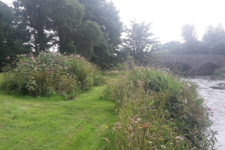
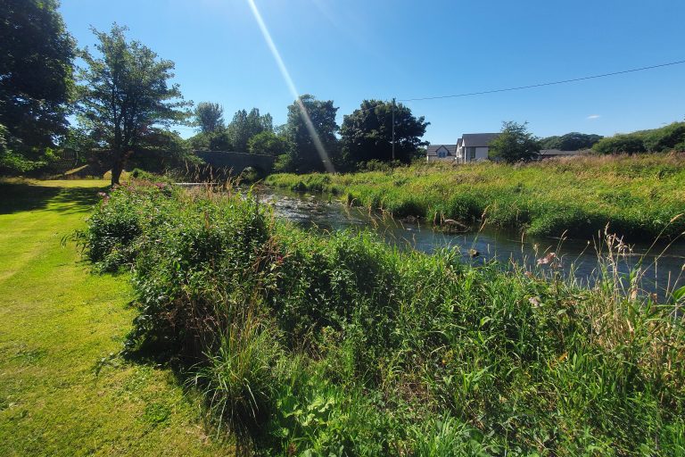
Before control, the abundance of Himalayan balsam was ‘dominant’ on the left bank and ‘occasional’ or ‘frequent’ on the right bank. Following 3 or 4 years of treatment in 2018, 2019, 2020 and 2021, a reduction in abundance was observed at all monitoring points. By 2022, abundance had reduced to ‘abundant’ on the left bank at all monitoring points except for one where it was ‘frequent’, while still occurring as ‘frequent’ or ‘occasional’ on the right bank. This is shown by the recorded abundances in Table 2 and fixed-point photography at each site (see Figures 1a, 1b, 2a and 2b below).
Before control of Japanese knotweed began in 2019, there were no plants visible on the right bank and an ‘abundant’ stand on the left bank. Control work in 2019 and 2020 reduced the abundance of Japanese knotweed from ‘abundant’ to ‘rare’ in 2020, with no regrowth observed by 2021 and in 2022. This is shown by the recorded abundances in Table 3.
Table 2 – Annual Himalayan balsam abundance from surveys (2018 – 2022) at Ravenscraig Castle to Inverugie Bridge, River Ugie
| Site Name |
Himalayan balsam abundance by year (DAFOR* scale) |
| |
2019 |
2020 |
2021 |
2022 |
| Ravenscraig Castle to Inverugie Bridge – left bank 1a |
D |
D |
A |
A |
| Ravenscraig Castle to Inverugie Bridge – right bank 1a |
O |
F |
F |
O |
| Ravenscraig Castle to Inverugie Bridge – left bank 1b |
D |
D |
A |
A |
| Ravenscraig Castle to Inverugie Bridge – left bank 1c |
D |
A |
A |
F |
| Ravenscraig Castle to Inverugie Bridge – right bank 1c |
F |
F |
O |
O |
Table 3 – Annual Japanese knotweed abundance from surveys (2018 – 2022) at Ravenscraig Castle to Inverugie Bridge, River Ugie. Only one knotweed stand was present at the site
| Site Name |
Himalayan balsam abundance by year (DAFOR* scale) |
| |
2019 |
2020 |
2021 |
2022 |
| Ravenscraig Castle to Inverugie Bridge – left bank 1b |
A |
R |
N |
N |
* – DAFOR Scale of abundance – D = Dominant (50 – 100% cover), A = Abundant (30 – 50% cover), F = Frequent (15 – 30% cover), O = Occasional (5 – 15 % cover), R = Rare (<5% cover), N = Not Present (0%)